地图
Cartography 豆瓣
作者: Matthew H. Edney 出版社: University of Chicago Press 2019 - 4
Over the past four decades, the volumes published in the landmark History of Cartography series have both chronicled and encouraged scholarship about maps and mapping practices across time and space. As the current director of the project that has produced these volumes, Matthew H. Edney has a unique vantage point for understanding what “cartography” has come to mean and include.
In this book Edney disavows the term cartography, rejecting the notion that maps represent an undifferentiated category of objects for study. Rather than treating maps as a single, unified group, he argues, scholars need to take a processual approach that examines specific types of maps—sea charts versus thematic maps, for example—in the context of the unique circumstances of their production, circulation, and consumption. To illuminate this bold argument, Edney chronicles precisely how the ideal of cartography that has developed in the West since 1800 has gone astray. By exposing the flaws in this ideal, his book challenges everyone who studies maps and mapping practices to reexamine their approach to the topic. The study of cartography will never be the same.
世界地图集 豆瓣
作者: 总参谋部测绘导航局 出版社: 星球地图出版社 2015 - 1
地图是初始信息的科学加工。随着对地观测技术的进步,传感器的分辨率日益提高,遥感图像已成为人们获得地面信息的最主要来源。但对于大多数用户来说,遥感图像需要解译,经过定性、定量分析和分类分级处理,将数据变成信息,将有用的内容以标准的符号与色彩标志出来,依用户的要求而制成各种各样的地图。这是一个科学加工的过程。我们不能要求大多数的用户从像片判读开始建立自己的“心象世界”,而应该将做好的地图提供给他们,把初始信息的首层加工交给制图专业人员去完成。
这就是为什么我们进入信息时代后还要不断地出版地图的原因。地图集是地图的有机集成,作为认识世界的结果和再认识的工具,具有不可替代的特点:
第一,地图集不仅仅是技术产品,更重要的,它是一个时期人类认识客观世界的科学成果的记录,代表着知识的积累与文明的积淀。出版地图集是人类科学史和认识史的要求,并因此而永远保持其存在的价值。
Atlas of the World's Languages 豆瓣
作者: Asher, R. E. (EDT)/ Moseley, Christopher (EDT) 出版社: Routledge 2006
Before the first appearance of the "Atlas of the World's Languages" in 1993, all the world's languages had never been accurately and completely mapped. The "Atlas" depicts the location of every known living language, including languages on the point of extinction. This fully revised edition of the "Atlas" offers: up-to-date research, some from fieldwork in early 2006; a general linguistic history of each section; an overview of the genetic relations of the languages in each section; statistical and sociolinguistic information; a large number of new or completely updated maps; further reading and a bibliography for each section; and, a cross-referenced language index of over 6,000 languages. Presenting contributions from international scholars, covering over 6,000 languages and containing over 150 full-colour maps, the "Atlas of the World's Languages" is the definitive reference resource for every linguistic and reference library.
唐代的长安与洛阳(地图篇) 豆瓣
作者: [日]平冈武夫编 出版社: 上海古籍出版社
长安和洛阳这两个都城,是唐代文化画卷在其上展开的最主要、最大的场所。因此,了解这两个都市的宫殿、街道、道路、市场、寺庙乃至园林、住宅等等的状态和位置,或者一个街坊中知名的居住者的情况等等,对于具体地了解唐代的人文事实,十分有用。编者根据文献描绘编制了长安城图、六坡图、长安坊里图等47幅和阁本兴庆图、长安南郊图等5幅插图
中国少数民族分布图集 豆瓣
作者: 郝时远 出版社: 中国地图出版社 2002 - 8
本地图集辅助各少数民族的人物形象和文字说明,提供了各少数民族的分布情况,并提供了从抽象到具体、从历史到现实、从平面到立体的感知空间。 本图集由序图和专题图两部分组成。序图中有中国政区、中国景观、中国民族分布、中国民族自治地方分布图4幅图。中国民族分布图后附有中国少数民族分布简表,中国民族自治地方分布图后附有中国少数民族自治地方基本情况简表。专题图中,每一个民族都占有相同的页码,有位置显示图和少数民族分布图及文字说明及历次人口普查中该民族的人口统计图表。本图集是严格的科学性和鲜明的政治性自然融合的结晶之作,是研究我国少数民族不可多得的参考工具。
清朝地图集1:同治至宣统卷 豆瓣
作者: 侯杨方(主编) 出版社: 星球地图出版社 2019
《清朝地图集——同治至宣统卷》为六卷本《清朝地图集》的卷,系统呈现了清朝同治至宣统年间的疆域版图、政区沿革以及自然、人口、经济、文化、历史事件等要素变动情况。《图集》由复旦大学中国历史地理研究所侯杨方教授主编。
《图集》共有175幅地图,分为总图组、分省图组和重大历史事件图组三部分。总图组包含全国图6幅,反映全国疆域政区变迁及经济社会文化状况;分省图组包含分省(地区)图28幅、政区沿革图55幅、专题图45幅、局部扩大图2幅;重大历史事件图组包含重大历史事件图11幅,反映政治、战争、经济等方面的重大历史事件。另有索引图28幅。在谭其骧主编的《中国历史地图集》出版后数十年间,学界陆续涌现出了一批区域历史地图集和专题历史地图集,但断代历史地图集还有且只有于民国和近代,清代及之前各朝代的断代地图集尚缺。《图集》使用GIS进行地理数据的汇总和校对,使得《图集》在精准度上较之前的历史地图有了明显的提高。《图集》首先利用高精度的DEM地形数据制作了地形地貌底图,再结合历史资料和地理数据复原生成山川、海岸等自然信息,之后再叠加政区、经济、人口、交通、居民点等人文要素,很终整体核对地图各要素,从而使得各方面内容准确协调。
根据清朝历史进程和研究资料情况,《清朝地图集》采取按时期“逆推”方式分卷绘制,首先绘制同治至宣统卷,再逐步绘制清朝前中期地图。之所以优先绘制同治至宣统卷,是因为清末地图和文献档案资料充足,有利于优选程度地保证地图的精准性,这样复原清朝前中期疆域政区就有了坚实可靠的基础,从而做到准确、全面地反映清朝近三百年疆域政区及经济社会文化的变迁过程。
The History of Cartography 豆瓣
作者: Harley 出版社: University of Chicago Press 1987 - 5
By developing the broadest and most inclusive definition of the term "map" ever adopted in the history of cartography, this inaugural volume of the "History of Cartography" series has helped redefine the way maps are studied and understood by scholars in a number of disciplines.
Volume One addresses the prehistorical and historical mapping traditions of premodern Europe and the Mediterranean world. A substantial introductory essay surveys the historiography and theoretical development of the history of cartography and situates the work of the multi-volume series within this scholarly tradition. Cartographic themes include an emphasis on the spatial-cognitive abilities of Europe's prehistoric peoples and their transmission of cartographic concepts through media such as rock art; the emphasis on mensuration, land surveys, and architectural plans in the cartography of Ancient Egypt and the Near East; the emergence of both theoretical and practical cartographic knowledge in the Greco-Roman world; and the parallel existence of diverse mapping traditions ("mappaemundi," portolan charts, local and regional cartography) in the Medieval period.
Throughout the volume, a commitment to include cosmographical and celestial maps underscores the inclusive definition of "map" and sets the tone for the breadth of scholarship found in later volumes of the series.
旧城胜景 豆瓣
作者: 钟翀 出版社: 上海书画出版社 2011
近代日绘鸟瞰地图,是指近代以来在日本形成的一种新式鸟瞰地图画法,此种鸟瞰地图多为日人绘师在习得西洋透视法鸟瞰地图的基础上,糅合日本浮世绘等传统绘印技艺所创制的独具特色的绘图。此类鸟瞰地图绘制准确、立体感强,且印刷精美,因此不仅具有较高的艺术价值,而且也有着相当的实用功能,故在当时常被作为旅游指南地图而得以流传。
本书收集了60余幅中国都市鸟瞰地图,均由日本绘师绘于上世纪二十至四十年代。全书按地域分为四部分,展示了北京、天津、济南、青岛、大同、大连、沈阳、长春、哈尔滨、上海、南京、苏州、杭州、武汉、重庆、广州、香港等二十四个城市在那个年代的面貌。这些鸟瞰图大都作于20世纪上半叶日本大陆侵略政策实施时期,其所描绘的我国东北、华北、长江流域及华南地区的都市鸟瞰地图大多以沦陷的城市为题材,赤裸裸地表现了日本军国主义的侵华野心,客观上也为我们研究、还原日据时代沦陷都市的历史原貌提供了第一手的图像史料。从今日的近代地图收藏、近代史与城市史地研究乃至史料保存等角度来看,皆具有很高的研究与收藏价值。
蒙古山水地图 豆瓣
作者: 林梅村 出版社: 文物出版社 2011 - 9
本书中的“蒙古”称雄欧亚大陆的蒙古四大汗国的后续王朝。该山水地图大约绘制于明代中叶,全面反映了明朝与西方的陆路交通,堪称明代丝绸之路地图,该山水地图的发现将推动 丝绸之路历史、考古和地理研究的深入。
“非科学”的中国传统舆图 豆瓣
作者: 成一农 出版社: 中国社会科学出版社 2016 - 2
《"非科学"的中国传统舆图:中国传统舆图绘制研究》内容有:《元和郡县图志》《太平寰宇记》和《元丰九域志》中的“四至八到”;明清方志中的“四至八到”;“制图六体”在中国地图绘制史中影响力的分析;对“计里画方”在中国地图绘制史中地位的重新评价;宋元方志中所记“四至八到”的性质等。
The World Atlas of Language Structures 豆瓣
作者: Martin Haspelmath / Matthew S. Dryer 出版社: OUP Oxford 2005 - 7
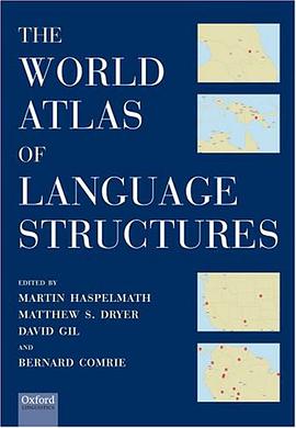
"The World Atlas of Language Structures" is a book and CD combination displaying the structural properties of the world's languages. 142 world maps and numerous regional maps - all in colour - display the geographical distribution of features of pronunciation and grammar, such as number of vowels, tone systems, gender, plurals, tense, word order, and body part terminology. Each world map shows an average of 400 languages and is accompanied by a fully referenced description of the structural feature in question. The CD provides an interactive electronic version of the database, which allows the reader to zoom in on or customize the maps, to display bibliographical sources, and to establish correlations between features. The book and the CD together provide an indispensable source of information for linguists and others seeking to understand human languages. The Atlas will be especially valuable for linguistic typologists, grammatical theorists, historical and comparative linguists, and for those studying a region such as Africa, Southeast Asia, North America, Australia, and Europe. It will also interest anthropologists and geographers. More than fifty authors from many different countries have collaborated to produce a work that sets new standards in comparative linguistics. No institution involved in language research can afford to be without it.
中外交通古地图集 豆瓣
作者: 朱鉴秋 / 陈佳荣 出版社: 中西书局 2017 - 6
《中外交通古地圖集》選録123幅(套)涉及中外交通的中國古地圖,包括各歷史時期的全國輿圖、航海圖、沿海圖及有代表性的其他古地圖。每一幅中國古地圖(或幾幅同題材的中國古地圖)撰有一篇題解,對其繪製過程、流傳情況、歷史意義以及其中涉及的地名等詳加注釋,同時配置相近年代的外國古地圖作比照。外國古地圖的内容與中國古地圖没有直接聯繫,僅顯示中外古地圖的不同形式、特點及其演變。
本書不僅從國内文獻典籍中爬梳整理出一批涉及中外交通的的古地圖,更从牛津大學、耶魯大學等海外收藏機構搜集了一些重要的地圖,史料价值较高。